
Some weeks just seem to ooze colour and variety in skyscape and landscape. The week from the 18th to 24th November was one of those. From sunsets to storm structure to lightning.
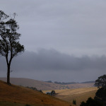
Starting the 18th with a most spectacular evenings display of colour from some of the smoothest cirrus skies you will ever see. And that was just one direction! The other had the ruffled look of unstable skies. Spoiled for choice.
-
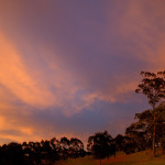
- 18th sunset – the border between smooth and rough
-
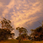
- 18th sunset – unstable cloud bases to my nth
-
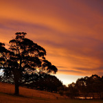
- 18th sunset – Smooth cirrus skies to the west
-
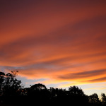
- 18th sunset – Smooth cirrus skies to the south!
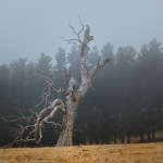
Then on the 20th the air filled with haze, threatened rain but delivered very little. The evening skies in the eastern ranges began to fog in .
-
- Hazy dark sky but no real rain
-
- Fog moving in
-
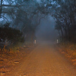
- Foggy drive
The 21st had a sky filled full of unstable altocumulus. Right on sunset it exploded into a popcorn sky, the likes of which I can’t remember to this extent. Was quite surreal.
-
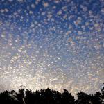
- popcorn sky!
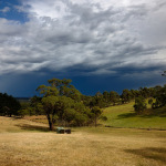
The 22nd started with very light rain for me and spectacular thunderstorms everywhere else. Nonetheless I had a good view being on the outside by a very few km of all the rain action. Late in the afternoon a weak cell finally made it south enough to get me, all of a massive 1.25mm of rain (not) and some reasonable views. Still better than nothing!
-
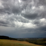
- Early morning start at instability
-
- Torrential rain skirting close all day, but mostly sun for me
-
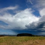
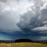
- Incoming cell – the beginning
-
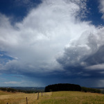
- Our only cell for the day #1
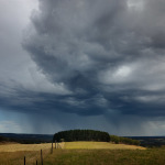
-
- Our only cell for the day #2
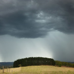
-
- Our only cell for the day #3
-
- Heavy rain in Onka Valley approaches
-
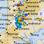
- Radar grab of our one and only cell!
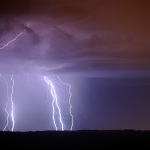
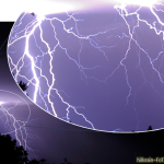
Then the early morning of the 24th and I am woken by thunder around 3am. Well I cant not get up and have a look! A nice line of very active mid level storms was on a “train line” just sth of me. It never got truly close enough to be spectacular but was great eye candy and worth getting out of bed from. But it was icy on the hill with cold strong outflow winds lowering the windchill temp close to 7 degrees. Just north and then just south. Seems to not be our turn for getting the rain these storms like to dump. Maybe next time? History would say unlikely. But as for the views… well, good enough for me.
-
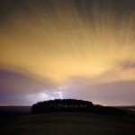
- They never really came close enough..
-
- A single flash! Just over the ridge this was a retina burner
-
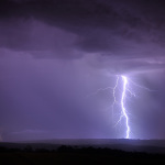
- Single powerful bolt
-
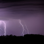
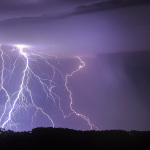
- more multiple strikes
-
- Multiple strikes
-
- Bats or birds silhouetted in the strikes